As floodwaters transform Kati Thanda–Lake Eyre into a spectacular inland sea, pilots are reminded to stay alert to increased air traffic, wildlife activity and specific broadcast requirements in the region.
Something extraordinary is happening in one of Australia’s most remote regions. Kati Thanda–Lake Eyre, the continent’s largest salt lake, located in South Australia, is coming back to life in a once-in-a-generation event – and it’s proving irresistible to photographers, tourists and aviators.
Following one of the most intense flood seasons in recent memory, water from Queensland is surging into the lake system. Lake Eyre, which sits at the lowest natural point in Australia – 15.2 metres below sea level – stretches an astonishing 144 by 77 kilometres. As it fills, it transforms the stark, thirsty Outback into a thriving, temporary ecosystem.
Birdlife flocks to the region from across the globe, including pelicans, ibises, egrets and spoonbills, with some travelling from as far as China and Japan to take advantage of rare nesting opportunities. Camels, dingoes and feral pigs have also been sighted, along with bream, yabbies and freshwater shrimp that flourish in the lake’s shallow waters.
Record-breaking rains bring new aviation challenges
Although Lake Eyre rarely dries completely, this season’s deluge means it will likely fill to levels not seen since 1999.
‘It’s quite an amazing sight to see all that floodwater making its way down from Queensland,’ says Tim Penney, one of CASA’s aviation safety advisors.
‘Many areas are below sea level and end up filling with vast amounts of water, and with that comes an explosion in birdlife and aircraft activity.’
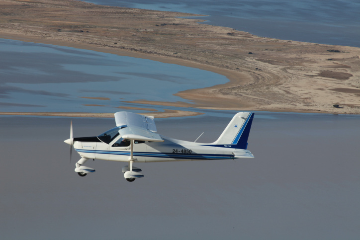
With the spectacular natural transformation comes a sharp increase in sightseeing flights. Aircraft frequently operate between 1,500 and 5,000 feet above ground level (AGL), creating a higher density of traffic than usual for the region.
‘This is Class G airspace, so pilots are responsible for arranging their own separation,’ Tim explains. ‘There’s a designated broadcast area around Greater Lake Eyre and pilots should use frequency 127.8 to make position broadcasts whenever reasonably necessary to avoid a collision.’
He advises pilots to make an information broadcast when entering the broadcast area at or below 5,000 feet, referencing position by nearby airstrips or relative to Lake Eyre North or South. It’s also recommended to broadcast when over significant features as shown on aeronautical charts.

Scenic flights, local knowledge and safe practice
For those unfamiliar with the area, Tim strongly encourages contacting local commercial operators for a safety briefing.
‘The best point of contact is Wrightsair, based at William Creek,’ he says. ‘They’ll be able to provide current information on traffic patterns and areas of high activity.’
Pilots conducting scenic flights are encouraged to fly in a clockwise direction to support traffic flow. While most commercial scenic flights operate between 1,500 and 3,500 feet AGL, aircraft may be encountered at any level within the broadcast area depending on the operation.
Tim also reminds pilots climbing or descending through 5,000 feet in the Lake Eyre region to broadcast their intentions on 127.8.
Importantly, pilots should note that landing on the lake or anywhere within the Kati Thanda–Lake Eyre National Park is prohibited without emergency necessity or prior permission from Parks and Wildlife.
‘It may look solid, but the lakebed can’t be relied on to support the weight of an aircraft,’ Tim warns. ‘It’s not worth the risk.’
Resources for pilots
Pilots flying in the region should refer to ERSA Special Procedures 10, which outlines procedures specific to the Lake Eyre National Park area.
They should also familiarise themselves with the rules for operating in designated remote areas under CASA’s Part 91 – Meaning of remote area (MOS 26.65). CASA’s plain English guide offers an accessible explanation of these requirements.


