Remotely piloted aircraft systems are adding speed and accuracy to aircraft accident investigation
Use the words ‘drone’, ‘accident’ and ‘investigation’ in the same sentence and the likely assumption from many would be that a safety agency is investigating an accident caused by a drone. But as the drone era gets underway, so far they are more likely to be the tool rather than the object of accident investigation.
Tom Farrier chairs the International Society of Aviation Safety Investigator’s (ISASI’s) Unmanned Aircraft Systems Working Group and is also a member of the International Civil Aviation Organisation’s (ICAO’s) working group on accident investigation. Recently, he and colleagues released a 120-page paper for ICAO working group discussion on drones (remotely piloted aircraft systems: RPAS) and accident investigation.
Tellingly, the working group’s initial focus was on factors agencies should consider in investigating drone accidents, the likelihood of which increases in line with the exponential growth in drone use, commercially and recreationally.
However, that focus has changed, and more and more, agencies worldwide such as the UK Air Accidents Investigation Branch (AAIB), the US National Transportation Safety Board (NTSB), New Zealand’s Transport Accident Investigation Commission (TAIC), and the Australian Transport Safety Bureau (ATSB) are realising the potential for drones as an integral part of the accident investigator’s tool kit.
The UK AAIB has been described by NTSB colleague, Bill English, as the ‘godfather of drone usage in accident investigation’. Stuart Hawkins, who led the project to procure drones for the AAIB, gave a presentation at the 2016 ISASI conference, where he described the AAIB’s drone activity. ‘We bought our first drone, a DJI Phantom 2 Vision (P2V) for £832 ($A1500) in February 2014, and first used it at an accident site on 14 March 2014. Its 14-megapixel camera provided excellent stills, although the video quality was shaky due to a lack of a gyro-stabilised mount.’
Since that time, the growth in drone numbers, operated both commercially and recreationally, reflects their increasingly sophisticated capabilities. Stabilised video capture in 4K high-definition, a mechanical shutter allowing shutter speeds of eight seconds to 1/2000 sec, infrared sensing, increased endurance/battery life and data storage, and the convergence of this improved drone and camera capability with easier-to-use post-processing software mean the newer prosumer drones are proving their worth in accident investigation.
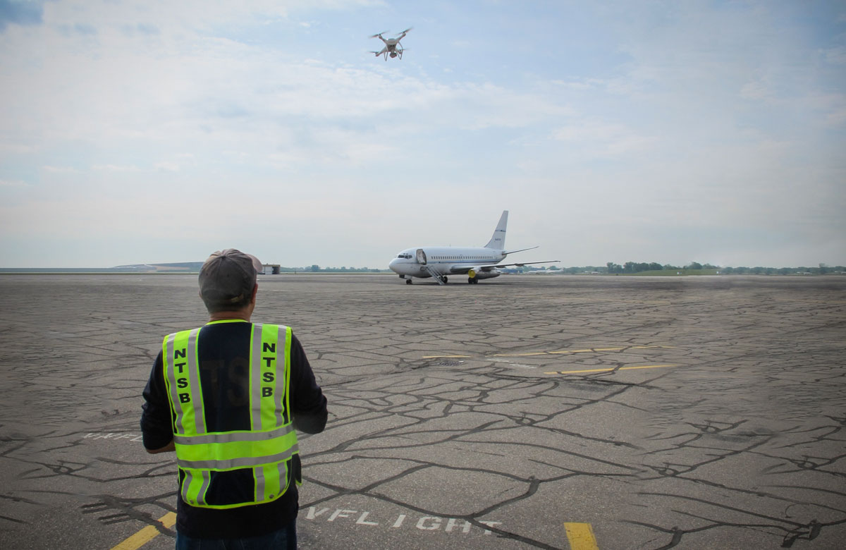
The ATSB are relative newcomers in the field, but with Chief Commissioner Greg Hood’s committed support, in July 2017 they gained their remotely piloted aircraft operator’s certificate (ReOC). Their team of six licensed drone pilots/investigators, includes experienced investigator, Derek Hoffmeister, who acts as chief pilot. One of the team also doubles as a maintenance controller, looking after the Bureau’s DJI Phantom 4s, (four Pros and one standard). ‘It’s good,’ Hoffmeister says, ‘to have someone across battery management’, and to ensure the aircraft are airworthy. The ATSB uses drones at most onsite accidents they investigate (some investigations are desktop or airline-procedure focused). In comparison, the NTSB investigates about 2000 accidents annually, and of these use drones for only a small percentage.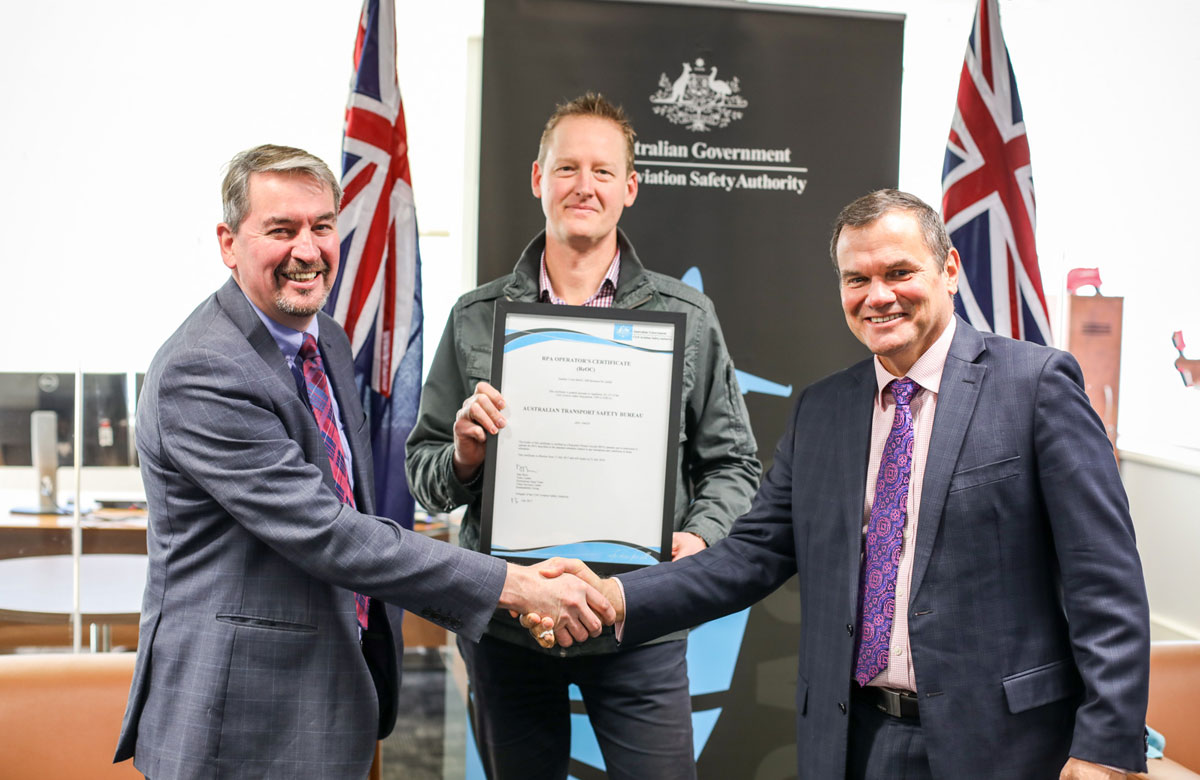
The advantages of drones
The ATSB’s first drone deployment was at last year’s derailment of a coal train near Oakey in Queensland. Using the drone meant investigators could fly the length of the 600-metre-long train, getting a full record of the accident site. ‘We could get images of the train, and the track before the accident,’ Hoffmeister says, ‘as well as flying down both sides of the train, slightly above carriage height.’
The drone’s capacity for recording accident sites accurately, comprehensively, and in a timely way is something Bill English, NTSB unmanned aircraft systems lead, whose day job is as a senior major air carrier investigator, reinforces. ‘You’re able to very thoroughly complete site documentation getting more detail in the amount of time. Obviously, you can go out and survey, and take laborious measurements of things, but that takes a lot of time. The same area can be covered by a drone in about 30 minutes, and you drop it into photogrammetry, and you don’t miss anything. There’s nothing you forget to measure: it’s all there,’ English says.
‘We’re now able to use the drone to make very accurate and complete wreckage diagrams of aviation accidents that might have parts of an aircraft strewn about in difficult terrain. In our kit, we take a differential GPS with us, so we can put down ground-control points and make the accuracy to the level we require. I’ll get 10-cm or less absolute accuracy on a routine basis. I’ve tested the differential GPS using survey markers from the county. I can get down to within 4-cm without any difficulty. That’s far better than historically any NTSB ground mapping has ever been. Additionally, when we can map the runway in half the time, that means we can give that runway back to the airport authorities, and they can get it fixed, open and airline traffic operating off that runway much more quickly.’
Traditionally, investigators have used helicopters to get overhead views of an accident site, but Hoffmeister says, ‘drones are easier, cheaper and less intrusive. Helicopters are actually quite intrusive at an accident site because of the downwash, and they’re less controllable. With a drone we can take our time and get the photographs we want.’
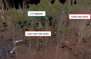
The investigators also agree that drones are valuable in giving a point of view not available by conventional means. ‘You get a look at things more closely,’ English says; for example, at an accident site, ‘we could see a tree-strike about 80 feet above our heads. So, we could pull these out of the drone point cloud* and easily measure the angle, which would have been very difficult to do otherwise.’ (*A point cloud is a 3D-visualisation made up of thousands or even millions of georeferenced points. Point clouds provide high-resolution data and are commonly used in industry-standard software.)
As a former ‘crash-scene walker’, Tom Farrier, chair of ISASI’s drone working group, says this 3D-modelling, allowing investigators to see ‘relief of terrain’, is very useful.
The timeframe in an investigation can be critical, and Farrier, chair of ISASI’s drone working group, describes an accident site he attended a few years ago, where the drone’s capacity to document quickly would have been invaluable. ‘Accident sites are rapidly changing scenes,’ he says, ‘and you either have to get them tidied up very quickly, or risk non-participants intruding. Every single day the weather changed: on day one the site was a peat-field bog, on day two it rained, and on day three it was snow-covered.’
‘When you first arrive at an accident site,’ Hoffmeister says, ‘you want to make sure that all parts of the aircraft are in the same spot. So RPAS are good at searching for things: whether you’re searching for something, or searching to ensure nothing is missed.’
Another advantage of using drones is the ability to recreate flight paths. Hoffmeister says the ATSB used a drone in a recent Talbingo helicopter accident in Australia’s Snowy Mountain region. ‘We knew where the helicopter was, and where it ended up, so we flew that path from a pilot’s point of view. How valuable that will be in the investigation we don’t know, but it was interesting data to capture, and we have it there.’
Not only do drones assist investigators in photography and surveys of accident sites, but Farrier says, drones also contribute to protecting investigators’ safety. He describes the use of drones to assess crash sites, using infrared and chemical sensors, for example, to identify hazards to investigators, such as chemicals or windborne gases, fuels and other contaminants. ‘High-end unmanned aircraft,’ he says, ‘are kind of like a Swiss Army pocket knife: something you can take different payloads off or put different payloads on. Thermal sensors, visible and invisible light spectrum sensors, chemical sensors—it’s a matter of picking the right kind of sensor for the right environment.’
Hoffmeister says the safety of investigators was one of the arguments used to justify the purchase of drones for the ATSB. ‘Before we go on site, if we have any concerns, we can send in the RPAS to have a look first—there are always plenty of hazards. It could be a pressure vessel, fire, electricity, or an ag accident where there might be chemical contaminants. It could be a ballistic parachute—they’ve got quite a charge in them—so we could fly it in there and see if the cover’s still on, whether it’s been set off or not.’
The challenges
The investigators agree that flying drones for accident investigation is not without its challenges: anything from airspace to avian inhabitants of that airspace (‘wedgetail eagles tend to pay us a fair bit of attention,’ Hoffmeister says), not to mention bandwidth, batteries and weather. ‘Aviation accidents, more often than not, take place at airports, at take-off and landing,’ he says, which adds some complexity to drone flying. ‘Our ReOC does give us more flexibility, so at a recent accident at Mordialloc, we were able to operate within one kilometre of the airport with an exemption from CASA. We communicated with the tower on VHF radio and were able to do the survey in between traffic.’ However, as a concession, and to ensure they surveyed at a time with less traffic, investigators had to operate on a Sunday morning.
The sophisticated cameras now on many drones capture gigabytes and gigabytes of data, so managing this large data—the sheer size of files—can also be a problem. In more remote areas, or away from more efficient network services, ‘trying to upload multiple gigabytes from the hotel wi-fi is not cutting it,’ English says. He also says delivering these large files to unsophisticated users at the other end, so that they can view and manipulate them, can be an issue. As a government agency, security of data is another potential hurdle for drone use in investigation, English says. ‘You have great bandwidth at each end, with a drinking straw in the middle,’ and storing data in the cloud is not an option, because ‘cloud data makes government IT people nervous’.
For some investigators too, English says, the point cloud visualisation is a bridge too far. ‘They are more comfortable with pencils and graph paper; that’s definitely a hurdle, but one we will get over.’
Drones, especially of the prosumer variety which the agencies seem to favour, are becoming increasingly capable, but still have operating limitations. The lithium polymer batteries for example, which power them currently, give about 20-30 minutes flying time, do not operate well in extremes of heat or cold, and need careful management because they are prone to thermal runaway if mishandled, damaged or overcharged.
As with manned aircraft, drones face weather limitations: these drones do not perform well in windy, and especially gusty conditions, with their limit being winds of 20 knots; and in a crosswind, can get away from the operator, especially the more inexperienced.
Training and human factors
Being government agencies, the ATSB and NTSB are very much aware of the need for their drone operations to lead by example.
It is one of the reasons why the ATSB opted for ReOC certification, and their pilots have remote pilot’s licences. The NTSB, according to English, ‘far exceeds the Federal Aviation Administration’s (FAA) Part 107 minimums for small UAS. Our cadre of pilots require at least that entry requirement,’ English says, ‘but they must also hold manned aircraft certification—a private pilot’s licence as a bare minimum’ (although this does not have to be current). The NTSB then has its own standardisation training program, which encompasses guidance manuals and SOPs, and is based on larger US federal flight programs, as well as those of police departments which are more similar in size to the NTSB. Investigators must complete the accident standardisation program before they do any drone flying on site, including training on appropriate handling of data to ensure it complies with privacy rules, as well as meeting flight time minimums.
As with flying manned aircraft, human factors come into play with flying drones. Situational awareness is a shared HF concern, and like manned aviation, being head down monitoring a display can be a HF issue for drone pilots.
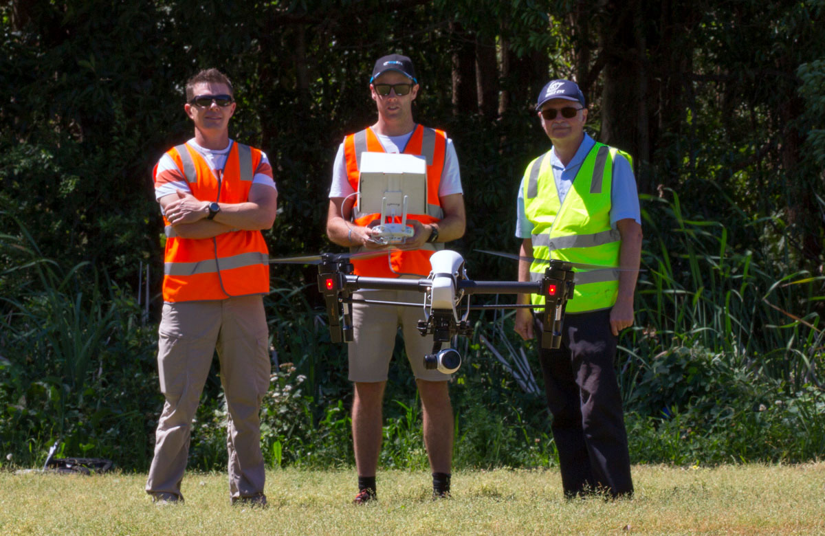
Both agencies operate their drones with visual line of sight—and there are physiological factors to consider in doing this. ‘Just because you can see it,’ Hoffmeister says, ‘it doesn’t mean you can control it as well as you think. It can be hard to tell which way it is facing, depth perception can be tricky, so you have to refer to the screen. If you’re flying using the screen, you need a second person as a spotter.’
At the Oakey investigation, the ATSB wanted to get images of the railway line before the accident site, so flew the drone just above the rails for some distance. This necessitated flying under powerlines, which could be monitored on screen, but they had a spotter to ensure clearance and to keep a lookout for manned aircraft.
‘Sometimes you don’t have enough hands to fly the drone and use the VHF radio,’ Hoffmeister says, ‘so a spotter also comes in handy to use the radio.’
The future
‘Eventually drones, and associated technology such as photogrammetry, will be seen as a normal tool for investigation. They will be an accepted and integrated part of the investigator’s tool kit,’ English concludes.


