Anonymous
After many years of on-again off-again training, I was finally the proud holder of a private pilot certificate.
I had been aware of an adventure whereby pilots could circumnavigate Bass Strait, hopping between islands from the mainland to Tasmania and back. I decided experiencing this adventure was my motivation for finally completing my PPL.
A longtime friend expressed his desire to join me, so we began months of planning and anticipation. We scheduled the trip in early summer for a decent chance of good weather, but before the likelihood of especially hot weather.
I was well aware of other pilots who had made mistakes that led to bad weather incidents, some of which sadly resulted in fatalities. Having never flown so far from terra firma before and being a sub-200-hour pilot in the middle of ‘the killing zone’, I had a suitably cautious gut feeling about the flight. But I knew that with proper preparation, there was no reason I couldn’t conduct this flight safely.
I was determined not to become a statistic.
I spent hours in AvPlan drawing out flight paths and read and re-read the special procedures for Bass Strait crossings in the ERSA. I contacted other pilots who had made the trip for their advice and briefed the flight with my instructor. Personal minimums were set, documented and communicated to my passenger to avoid ‘get-there-itis’.
We contacted the relevant local people and organisations along our path to organise permission, and book fuel, ground transport and accommodation where required. We invested in the requisite life jackets required for flight beyond gliding distance to land, and camping equipment for our overnight on Three Hummock Island.
Finally, after what at times felt like years of planning, the big weekend arrived. After a good night of sleep, we were at the airport on time. We loaded our gear and I conducted the preflight inspection with more attention to detail than normal, considering the over-water flying we were about to conduct.
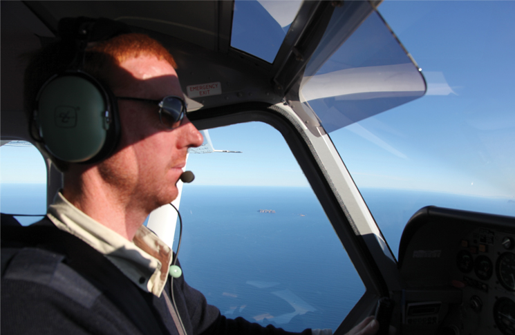
Before long we were in the air and Melbourne Centre had given us clearance to track through the Class C airspace over Port Philip Bay at 6000 feet as planned. Blue sky above, unlimited visibility around us and that cool calm morning air had us cruising along comfortably, on top of the world at this amazing privilege we were experiencing.
As we approached the edge of the Class C near Geelong, Centre terminated our control services and we switched over to flight following. But looking ahead, it suddenly didn’t seem like such a perfect day—clouds, and a lot of them. I called up Centre and we descended from our comfortable altitude of 6000 feet, lower and lower, until we were at 2500 feet. Visibility had deteriorated, but was still acceptable as we were approaching Cape Otway, the point where we would put the mainland behind us and head out to sea toward King Island.
As we tracked south-west with Apollo Bay off to our right, raindrops began to hit the windscreen. Flashbacks to the ATSB accident reports of aircraft pushing on through Bass Strait weather ran through my head and I quickly decided to made a 270-degree descending turn to the left to put us on final for the only runway at Apollo Bay, where we could wait out the weather and assess our options.
Safely on the ground, I was quietly feeling quite pleased with my ability to recognise the deteriorating conditions and the decision to abandon our schedule to ensure the safety of our flight. ‘Get-there-itis’ wasn’t going to threaten this flight.
The rain was short lived; by the time we were wheels down at Apollo Bay, it had already passed. But there were still lingering clouds that would keep us lower than our documented personal minimums for the water crossing. We agreed to keep waiting. The radar and satellite imagery showed it was a narrow band stretching right across Bass Strait, but it was moving and shouldn’t last long. After little more than an hour on the ground, the sky had cleared and we were back in the aircraft preparing to continue
our incredible adventure.
This is where all the months of preparation and planning counted for nothing. I was unexpectedly at an unfamiliar airport. I had never even considered the possibility of landing at Apollo Bay in all the planning I’d done. But I had my ERSA and AvPlan, plus I’d even taken the opportunity to chat to a helicopter pilot who landed not long after we arrived.
Apollo Bay has a single runway that is perpendicular to the coast. Runway 27 approaches over the water, while runway 09 approaches over the Otway Ranges. The runway slope is 2 per cent downhill toward the water. Our new helicopter pilot friend advised that the local fixed-wing operators usually use the downhill slope of runway 09 to take-off over the ocean.
We taxied out to the runway threshold and I inspected the windsock. A gentle breeze blowing to the sea. Now I had conflicting data to process in determining my take-off. Do I follow ‘what the locals do’ and take-off downhill or do I go uphill but into wind? Looking up the runway, the terrain continued to slope up higher and higher beyond the threshold. Our little Piper Warrior loaded with full fuel and all our gear for a long weekend away was only about 20 kg below maximum gross weight. I was concerned we wouldn’t have the climb performance to out-climb that rising terrain.
That settled it. The wind was really only a breeze and the downslope would make up for it. Add to that the clear climb-out path over the ocean, and we were going to depart on runway 09.
We got to the top of the runway and I positioned the aircraft to make every last metre of runway available. Full throttle, brakes released and we were rolling. And rolling. And rolling. The trees at the other end of the runway suddenly appeared to have grown a lot in the last 10 seconds. Of course they hadn’t, but they were definitely getting closer. A lot closer. And fast.
Nose wheel off the ground. Airspeed too low. Don’t pull back. Accelerate in ground effect. Fight the instinct to pull back.
Our airspeed finally reaches Vx and I ease back on the yoke to maintain that speed and climb out over the trees and road at the end of the runway. We clear the trees by what was probably at least 50 feet, but felt more like five.
As we climbed back to a respectable altitude in the sky that was once again clear, I reflected on how I’d almost contributed to the statistics I was determined not to become. I have spent a lot of time since then reflecting on those few minutes and how it could have had a different outcome. Had the wind picked up during our take-off roll, we would have rapidly consumed the small margin we had.
Lesson learnt: I should have stopped and taken the time to make an informed decision, instead of rushing a decision on the spot with an engine spinning and a passenger eager to continue our adventure. ‘Get-there-itis’ got me after all.

Comments are closed.