Don’t get slack about your radio calls, as this pilot did
I was flying a white low-wing aircraft up the east coast. It was early winter on a Friday morning. The light was subdued with broken cloud at 4500 feet.
I had exited the Williamtown airspace after a busy half hour and was over land by half a nautical mile at an altitude of 4000 feet, having changed from the Port Macquarie discreet frequency to the standard CTAF (126.7), while monitoring the Area Frequency.
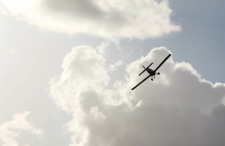
A C172 appeared ‘out of nowhere’, converging at my 10 o’clock on the same altitude – 4000 feet
I passed 10 nm east of Kempsey without giving a position report, overflew Nambucca Heads, gave my position approaching Coffs Harbour (ATIS advised that the tower would reopen the following Monday) and noted the next frequency change was at Evans Head, before descent into Ballina.
In other words, I was between airfields on CTAF in a reasonably popular lane, when I looked to the right and caught sight of a white T-tail disappearing beneath my wing.
The aircraft was over water and we were separated by 300 feet vertically and 600 metres laterally.
I hadn’t seen it although I was maintaining a reasonably focused watch because I’d flown this route many times. I usually fly over water because it gives the best view, especially at this time of year when whales are migrating north, but I was holding a direct track to Yamba. The contrast of land, water and broken cloud made for a grey outlook. I did not compute that I should have been on high alert, but it was enough of a near miss to make me sit up.
I used to give position reports at 10 nm from an airfield on CTAF, but I had become a bit blasé. I guess, with 600 hours, the more I fly, the more I think that I’m too experienced to waffle over the radio, but the cone of silence can be worse.
The next day, a friend confirmed that he too had become casual about position reports near uncontrolled airports. Radio calls augment ‘see and avoid’ and provide a rough fix on traffic when monitoring the CTAF frequency.
A few days later, departing Ballina to the west, I was within the 10 nm of Lismore and had given my position, when a C172 appeared ‘out of nowhere’, converging at my 10 o’clock on the same altitude – 4000 feet. I watched as it passed behind me by a calculated 150 metres.
I heard no call and the aircraft did not respond on the Ballina/Lismore CTAF (124.2). The Ballina Broadcast Area has since been increased to mandate aircraft carry radios and make appropriate broadcasts within 15 nm of Ballina.
Lessons learnt: I now make every position report but, even better, for the past 6 months I’ve been flying with an ADS-B compliant SkyEcho2. I like the fact that its distinctive icon reveals traffic across all EFB platforms. Anecdotally, I’ve heard that more GA pilots are beginning to accept ADS-B as another set of eyes in the sky.
More recently, as a VFR pilot – and making the appropriate radio calls – I was able to converse with an RPT aircraft descending into Barcaldine in heavy cloud, which enabled both of us to clarify positions and intentions.
DID YOU KNOW?
- SkyEcho 2 is the first low-cost ADS-B unit to be approved by CASA. Learn more by reading the feature ‘Low-cost ADS-B’ at flightsafetyaustralia.com
- CASA announced changes in January 2021 to the Ballina Broadcast Area, mandating the use of radio on 124.2 MHz within a radius of 15 nm around Ballina Airport, excluding the 30 nm arc from Gold Coast DME.
- • In August 2021, Ballina Airport withdrew the local certified air/ground radio service (CA/GRS) from service, which was replaced with the Airservices Surveillance Flight Information Service based in Brisbane Centre.
CLOSE CALLS: Why not share your story so that others can learn from it too? If we publish it, we’ll give you $500 for an article you’ve written yourself or $250 for a story over the phone. Email fsa@casa.gov.au


