
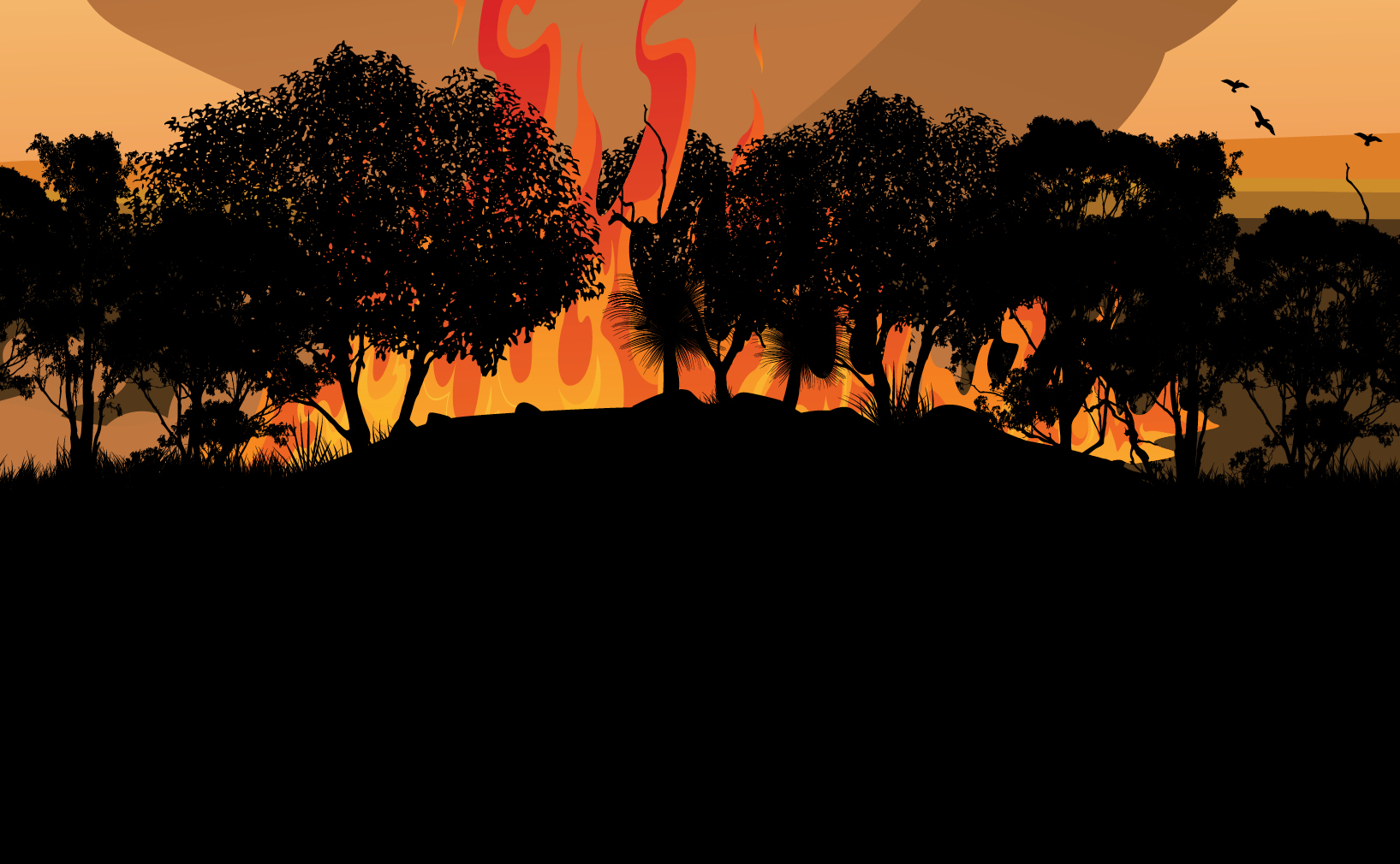
With climate change and now an El Niño upon us, bushfires are set to increase in frequency and severity. The atmospheric effects of these fires are a distinct aviation hazard in their own right.
All indications are for a severe bushfire season this year, with the Bureau of Meteorology declaring an El Niño (hot and dry) phase. This has been backed up by record hot-and-dry September weather in parts of southern Australia. Time to write about flying in or near bushfire smoke.
I’d had my own slightly rattling flying experience with smoke haze, but when I reached out to the aviation community asking for their ‘flying-in-or-near’ smoke stories, the response was astounding. Certainly, during the 2019–2020 Black Summer bushfire season, it appears smoke was an extraordinary challenge for many.
An unpleasant hazy memory
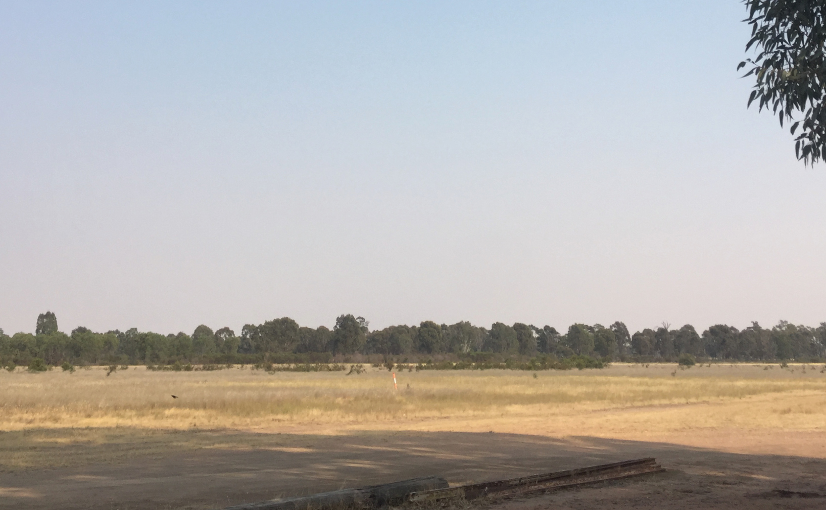
There aren’t too many hills around Euroa in Central Victoria, but I could see the one off the end of runway 19 clearly and, as you can see from my photo (next page), the sky was blue that morning. A very slight smell of smoke was hardly surprising given the Black Summer bushfires of eastern Australia were underway.
If you look hard enough at my photo, there is a smear of smoke haze. It’s hardly noteworthy, and it certainly looked no worse than city pollution can appear.
Euroa doesn’t have a full NOTAM service so I’d checked those available nearby and all appropriate TAF and weather reports. Visibility, it appeared, was OK for the short, local VFR flight I’d planned, so I took off.
About to depart crosswind at around 1,000 feet AGL, I glanced back at the airfield. I couldn’t see the runway!
Knowing there was no terrain to worry about, I maintained my height above ground and turned onto downwind. It took about 30 seconds but as I drew more perpendicular with the runway, I could see it.
Turning a short base, I kept the runway visual at all times and landed without incident. I took the photo after I landed because I didn’t believe visibility would be an issue and had been truly shocked I hadn’t been able to see the runway. At all.
In December that year, a pilot friend decided to ‘go up and have a look’ at the visibility near Mount Beauty, to see if a VFR flight was possible. Once again, the fires weren’t in the immediate vicinity, horizontal visibility seemed fine and weather reports were OK. He took off prepared to turn back and land should visibility not meet minimum requirements.
I didn’t believe visibility would be an issue and had been truly shocked I hadn’t been able to see the runway. At all.
At circuit height, his horizon was no longer clearly defined, although he could see directly down and about 3 or 4 nautical miles of ground radially. At 2 miles out, he could no longer see the ground and decided to head back. Great decision. En route home in the car, he assessed the visibility (using a couple of known, high landmarks) as being around 2 kms! Nowhere near minimum visual conditions.
In November 2022, some friends and I decided to tackle Bass Strait in company. We’d left the mainland headed for Hogan Island, when some smoke haze at our flight level, about 5,000 feet AMSL, meant we lost the horizon as a point of reference but could still make out the water below. Keeping an eye on the artificial horizon, we reduced height a hundred feet or so and suddenly it was no problem. The horizon happily came into view and along with it, Hogan Island.
Particulate matter
Bushfire smoke consists of various gases and particles – carbon monoxide, carbon dioxide, nitrogen oxide, water vapour, ash and other airborne particles. More technically, this soup is called ‘particulate matter’. Aside from the health risks of breathing in the toxic mix and concerns regarding potential engine damage, it’s the particulate nature of smoke that creates visibility problems for pilots.
Visibility can be confusing. It can be fine in one direction and not another. To understand why, it helps to think of smoke as particulate matter.
Horizontal, vertical and diagonal visibility
When I looked up at the sky over Euroa and it seemed clear on the ground, potentially I was looking through a relatively thin layer of smoke that resided between, say, 800 and 1,000 feet; that is, vertically 200 feet thick. From the ground, I was looking up through 200 feet of particulates.
But when I was nearing 1,000 feet on crosswind, looking back to the airfield, it might have been more like 500 feet of particulates because my line of sight went diagonally through the layer.
Visibility can be confusing. It can be fine in one direction and not another.
As I drew more perpendicular to the runway, on downwind, I was still looking diagonally but more directly down – through fewer particulates – maybe 300 feet. When I was at 5,000 feet over Bass Strait, trying to find the horizon, I was looking horizontally at perhaps hundreds of miles of particulates obscuring my view. This is why the horizon looked murkier than diagonally down or directly below for the Mt Beauty pilot.
But visibility through smoke also depends on how dense the particulate matter is (the denser the smoke the blacker it is), where the sun is in relation to us and the smoke, whether we are in the smoke or not and where the object we want to look at is in relation to all of those factors. It’s easy to see why it’s difficult when you’re on the ground doing your planning to be certain about ‘what it will look like’ up there.
Smoke-related visibility in weather reports
On weather reports and forecasts, smoke is abbreviated as FU. Specifics of the smoke conditions can often be found in remarks sections as BUSHFIRE SMOKE or SMOKE.
Visibility (VIS) is reported as a horizontal surface condition, usually between 1.5 and 2m (eyesight) above ground level. Horizontal visibility is described in 4 numbers – 9,000 means 9 kms.
Vertical visibility (VV) is reported in Aerodrome Forecasts (TAF), critical locations on Graphical Area Forecasts (GAF) and on METAR and SPECIs but only at locations with a human observer.
By definition, visibility is measured as the distance through a meteorological obscuration (the particulate matter that makes up bushfire smoke) that an observer can identify an object. If I’m standing on the ground looking up at an aircraft through a smoke haze, at what distance vertically can it be seen?
If the base of the smoke is 5,000 feet above the ground, that’s called a ceiling height. It is equivalent to an overcast cloud layer at the same height. VV ceiling height is described in feet, using only 3 numbers (050 describes 5,000 feet) in a TAF. VV/// means the vertical visibility is unknown.
When there is an inversion layer trapping the smoke below it, then the top of the layer of smoke can also be forecast in a GAF as, ‘Thick layer of smoke with estimated visibility of 0500m between 0500/2000FT.’
Smoke and weather
When bushfire smoke plume rises, it cools, potentially creating a pyrocumulus cloud. If the clouds are thick enough, a thunderstorm will develop, causing turbulence and bad weather, including downbursts, lightning, thermals, updrafts and or downdrafts. Basically, pyrocumulus clouds can create their own weather system.
Pyrocumulus clouds can also be quite difficult to see through smoke haze or surrounded and hidden by other cumuliform clouds, giving pilots less chance of identifying potentially turbulent and dangerous conditions.
Smoke haze can also get trapped below inversion layers, where the air is warmer above the smoke than the air the smoke is in, particularly during morning and evening hours, in valleys or in bowl-like terrain. But worse, the smoke itself blocks the sun from warming the air underneath, intensifying the inversion layer, leading to denser smoke concentration and preventing the smoke from dissipating. It’s a type of weather loop that needs warmth, wind, or rain to clear it away.
If I was a pilot flying anywhere near a bushfire, I’d be making sure I stayed well away.
Other hazards: animal and mechanical
There are 2 types of airborne creatures that can flock to bushfires – those sent to put the fire out (aerial firefighting and survey crews) and those looking for a free-for-all feast – birds. Insects fleeing the bushfire en masse create ‘clouds’ of easy prey for birds, increasing the likelihood of an aircraft bird strike. The other type, fire-related aircraft, are also a collision hazard during trips away from fires to pick up water or fuel.
Charles Mahoney has been aerial firefighting for about 5 years, water bombing, air attack, observation and mapping, principally in a Squirrel helicopter. And he has some good advice for pilots flying in the area of bushfires.
‘There might be 2 fire-related aircraft in there, or 10, or the large air attack aircraft,’ he says. ‘You won’t know because when they’re talking to one another – and it can get really busy and intense – they’re using a discrete frequency. They’re listening out for you on Area frequency and CTAF if appropriate, but you won’t hear them unless they call on those frequencies. And if you hear one, you can’t assume there’s just one aircraft.
‘And if it’s a larger fire, I’d be on the lookout for large air tankers, like the 737, that may be descending from controlled airspace into a low-level environment to do a drop. I might get a fright if one of those popped out in front of me – and so might the air tanker!
‘Also, I’d be mindful at the airports surrounding the fire because aircraft may be refuelling, making them busier as well. And I’d take care when flying across the routes between the fire and an airport where they may be refuelling.
‘If I was a pilot flying anywhere near a bushfire, I’d be making sure I stayed well away. Keep above 3,000 feet AGL and 5 miles clear. Make any necessary deviation in clear air around the upwind side where possible.
‘Check your NOTAMs and if you see a fire, give it as much clearance as you can, keep your eyes outside and listen out on the relevant frequencies.’
Call if you get into trouble
In another Black Summer story, 2 private pilots were travelling from central NSW to Moorabbin in Victoria. After waiting a few days for the conditions to improve, the weather forecasts, including TAFs along their route, were finally favourable for their flight home in a Cessna 172. So off they went.
Levelling off at 6,500 feet, the visibility really wasn’t great. The pilot in command looked at the co-pilot and said, ‘So this is what 8,000 visibility looks like. Wow!’ They began to get seriously concerned, thinking, ‘What other airports are nearby? Would they be usable or covered in smoke? Was it an option to turn back?’
Being VFR pilots, they weren’t used to contacting air traffic control and felt if they called, it would be like confessing a sin. But they decided to suck it up. They needed help.
Melbourne Centre, Zulu Tango Quebec.
Zulu Tango Quebec, go ahead.
Zulu Tango Quebec, VFR Cessna 172, is 50 miles to the north of Yarrawonga at 6,500 and in marginal VFR conditions due smoke.
Zulu Tango Quebec, would you like to upgrade to IFR? (It was almost funny that both pilots had just passed their PIFR theory exams!)
Unfortunately, we are not IFR pilots. Is it possible to get a condition report of a nearby airport suitable for us to divert to?
Zulu Tango Quebec, what is your endurance and say your POB.
We have approximately 3 and a half hours of fuel and 2 POB. We are currently on autopilot.
And that’s when the magic happened. ATC received calls from every direction, from other pilots in the area and on their route, giving all of the options and advice those pilots could have wished for. ‘The lessons were many,’ the pilot said later. ‘But most significantly, if in doubt, call for help!’


