Most of Flight Safety Australia editor Ross Peake’s working decisions are made in the office (or home office). So it was a refreshing change and a reminder of the realities of psychological pressure to make a solo flight to outback Queensland.
The hardest part of my first decent solo trip since gaining my private pilot licence was battling the gravitational-like pull of get-there-it is.
Many readers will know the feeling – you are fairly sure you can get through to your destination even though the weather is marginal.
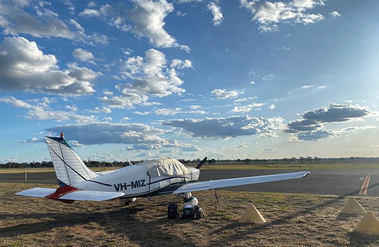
I was in the Canberra Aero Club’s Archer, heading up to Longreach to see the Qantas Founders Museum, via Charleville (where I first began to commit journalism, many years ago).
Being super cautious, I stayed overnight at Narrabri and touched down at Charleville the next day. The trip was trouble-free, flying at 8,000 feet IFR, with some practice going through clouds and doing RNAV approaches.
However, on the Sunday night, a trough was moving in from the Northern Territory, as forecast. The line of storms looked dangerously bright on AvPlan. But this was a big adventure, wasn’t it? And the trough was moving slowly, wasn’t it? (But was there a viable alternate?)
Next morning, there I was, sitting in the cockpit at 0630, ready to go, but truly undecided – which is surely a good indicator in itself. What was running around in my head were all the stories I’d read over many years in Flight Safety Australia about people who took off into blue skies but ended up spinning out of clouds or finding a mountain in one. And since you’re reading these words in the print or online edition of Flight Safety Australia, you’ve probably read many of those sad tales as well.
Now let’s add some pressure to this hobby pilot. As editor of this magazine, it would not be a good look if I blundered, such as encountering wind shear from a seemingly distant storm, and bent the aircraft. So, despite having a PIFR, I reluctantly decided to tie down the aircraft and drive from Charleville to Longreach. The NRMA trip planner indicated 5.5 hours travel but, add in breaks and slower speeds due to heavy rain, and I spent 8 hours on the road that day. Was that really the safer way to go?
As pilot in command, the go/no go decisions rest on your shoulders alone.
You have to be satisfied the decision made was the right one. Even though the drive was long, I knew I could – and did – pull over for a break; however, I was still questioning if I was being overly cautious.
As pilot in command, the go/no go decisions rest on your shoulders alone. That can feel like a fairly lonely place. And the situation is never helped if there is pressure from passengers who don’t appreciate just how quickly the weather can change. I didn’t have to worry about that factor and, fortuitously, I was in contact with 2 mentors during the 12-day trip: a colleague at CASA and Shelley Ross from Flying the Outback.
The CASA colleague has considerable professional flying experience. I’ve been on air safaris with Shelley, most recently to Tasmania, and have absorbed her detailed briefings on reading the weather and decision-making. As you might expect, they both backed my decision not to fly.
Sadly, the same day I decided to stay on the ground, a very experienced pilot crashed near Brisbane, resulting in 3 fatalities. The aircraft hit bad weather and dropped from about 2,000 to 500 feet, according to Nine News.
Hit the road
After making the decision to drive, and then arriving in Longreach safely, I was conscious to switch off from weather woes and relax for my 3 planned days there. As many readers know, the Qantas Museum is fabulous and I spent 6 hours there, including the tour of the 747, Super Constellation and 707. Being allowed to stand in the engine of the 747 is a nice touch. The next day was well spent visiting the School of the Air and the Stockman’s Hall of Fame.
Arriving back in Charleville on the Thursday, I could see the second (predicted) trough moving in. The farmers were happy. However, as soon as it passed, an east-coast low developed suddenly, resulting in SIGMETs for severe turbulence SFC/7,000 feet covering my planned southward track. Relax, be a tourist for a day, I thought – there’s no rush. The next morning, Sunday, I tried some circuits. It was like being in a washing machine! The landings were rather untidy, so 2 were more than enough.
The next day was predicted to be much calmer, according to the BOM. And it was. The air was very smooth as I tracked down to Bathurst at 7,000 in 3 hops. That left a shorter flight the next day and, as I was closing in on the airport, Canberra Approach vectored me to the west, undoubtedly to allow an RPT aircraft to land first, but then expertly set me up on a 6-mile final for RWY 12.
Plug and play
Just before my trip, I bought a pingUSB which detects ADS-B IN directly from other aircraft in the vicinity and connects on wi-fi with your iPad or other device used as an electronic flight bag. Those aircraft show up as green arrows, whereas other traffic is blue (on AvPlan, at least). As I was flying IFR, the aircraft already had ADS-B OUT, so this extra device was a useful aid for situational awareness.
Another portable ADS-B device, the SkyEcho 2, is the only such device approved by CASA. It provides ADS-B IN and OUT and is an eligible expense under a federal government rebate program.
The reason for my purchase was because I had been counselled about the scarcity of mobile phone towers in the outback, even though the location map on the ACMA site suggests reasonable coverage along main roads where I was going to fly. At 8,000 feet, the line of sight is 176 km so the iPad displayed traffic throughout the flight, even with only one bar of mobile coverage. Qantas flights going overhead at 40,000 showed up green, as expected, while aircraft further away were blue.
While this trip did not test the pingUSB as rigorously as I had hoped – because the flying leg to Longreach could not be completed – I believe it will be invaluable on a trip further out, such as to Uluru, to detect aircraft nearby when there may be no mobile phone coverage. I’ll let you know if I get there next winter.
A holiday to remember
We ask our close call contributors to discuss what lessons they learnt. So how did this trip work out for me? Well, I arrived home safely after putting myself through a challenge and enjoying some great flying. That’s a good result, any day. Importantly, I now more fully appreciate just how hard the go/no go decision can be. And although my plans were interrupted because of the weather, the trip was a powerful learning experience.
*Ross Peake bought the ADS-B device, and travelled, at his own expense.
| Get an ADS-B rebate! Grants of up to $5,000 are available to increase the uptake of ADS-B equipment in Australian-registered aircraft. Find out more at the ADS-B rebate program. |


Very interesting, Ross
You are a man of many hats.
Glad you took the more cautious route.
You can be around to tell us more fascinating stories.