

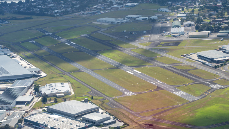
The opening of Western Sydney International Airport (WSI) on 26 July is generating the most significant airspace restructure of the Sydney Basin in decades. The changes take effect from 9 July, more than 2 weeks before the first cargo flight.
New control zones, revised VFR routes in and out of Bankstown, amended IFR procedures and updated boundaries across the region mean that any electronic flight bag (EFB) running last month’s data is already behind the curve.
The message from both major Australian EFB developers for pilots flying in and around Sydney is clear: don’t wait until the day.
What’s actually changing
The Sydney Basin is having a complete airspace restructure, not just a boundary tweak. Western Sydney, officially named Nancy-Bird Walton Airport, has been integrated into the Sydney terminal area, which now accommodates 5 airports: Kingsford Smith, WSI, RAAF Base Richmond, Bankstown and Camden.
Pilots flying in and around Bankstown or Camden, or transiting the Sydney Basin, must know before take-off the 2 requirements now applying to the newly established Class D controlled airspace: all aircraft must file a flight plan at least 30 minutes before estimated departure and must have a Mode A/C or Mode S transponder fitted for operation in this Class D airspace, and all aircraft (VFR and IFR) require an ATC clearance. That includes transits. No clearance, no entry.
Coded clearances which contain route, altitude and reporting point information to reduce frequency congestion for the most common VFR routes are published in the 9 July ERSA, AIP SUP and the updated Airservices Australia Sydney General Flying Guide. Pilots should familiarise themselves with these as part of pre-flight briefing, not in the cockpit on frequency.
How OzRunways is handling it
OzRunways draws its airspace overlays directly from official Airservices Australia data, processed in step with each AIRAC cycle. The Sydney Basin changes are already being processed, with the updated dataset to be published as ‘pending’ data 2 to 3 weeks before it becomes active.
‘We aim to make pending data available for pilots to preview 2 to 3 weeks before it becomes active, so pilots will be able to study the changes well ahead of the transition,’ OzRunways customer support representative Jake Beswick says.
All OzRunways customers will receive a direct email ahead of the AIRAC cycle, with instructions on how to preview and download the new data.
OzRunways and RWY users also have access to SmartBrief and the graphical NOTAMs tool, which Beswick flags as particularly valuable during the transition period, when NOTAM activity around the Sydney Basin is expected to be high.
How AvPlan is handling it
AvPlan CEO Bevan Anderson flags an important subtlety: the ERSA and charts that have been produced by Airservices have received changes (via AIP SUP) before they are actually effective on 9 July 2026. ‘Printed charts and static documents won’t keep pace with the changes,’ he says. ‘Pilots need to be working from live, updated EFB data.’
AvPlan is manually amending both the Bankstown ERSA entry and its VFR and IFR maps to reflect the airspace as it will operate from go-live, providing ease of use when compared to using a combination of Airservices charts, ERSA and AIP SUP documents. Updated charts and ERSA were due to be visible on the AvPlan website by the end of June and will be live in AvPlan EFB and AvPlan web on 10 July.
Users will receive email and push notifications alerting them to the changes, with updated data available to download approximately a week before cutover. The app’s existing airspace alerting will also use the new CTR and CTA boundaries, meaning pilots will receive in-app warnings if they approach the amended airspace, provided their data is current.
Anderson’s most important tip: ‘Spend time reviewing the updated VFR charts and ERSA on live.avplan-efb.com and plan ahead using the new inbound and outbound VFR routes into Bankstown.’
Five tips for flying in the Sydney Basin from 9 July
Regardless of which EFB you use, both developers agree on the fundamentals.
- Benefits of using EFB. Information has been collated and displayed to be easier to use when compared to using a combination of Airservices charts, ERSA and AIP SUP documents and NOTAMs. Check your EFB data is current before use.
- Review the AIP Supplements. AIP SUP H84/26, H87/26, H91/26 and H98/26 detail the full scope of the airspace amendments. Read them before you fly.
- Check for pending data. Both OzRunways and AvPlan will publish updated data ahead of 9 July. Look for it in your app and download it early.
- Familiarise yourself with the new VFR routes. Inbound and outbound routes into Bankstown have changed. Spend time with the updated charts well before the transition date. Read Flight Safety Australia’s full guide to the Sydney Basin changes at flightsafetyaustralia.com/2026/06/cleared-for-take-off-get-ready-for-sydneys-new-airspace/
- When in doubt, ask. Both EFB teams have pilot support teams on hand for the transition period.