
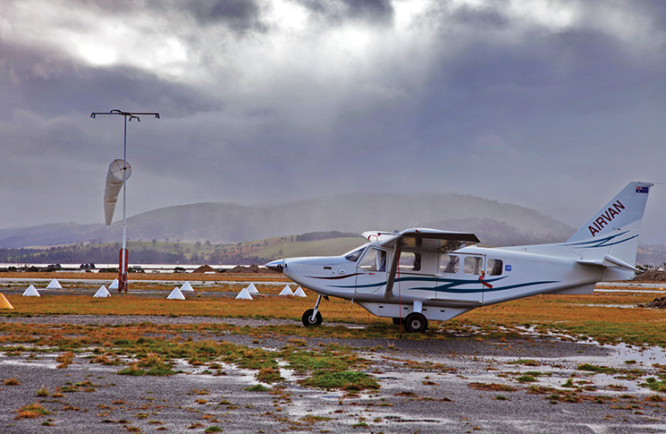
Winging it is for birds. Kreisha Ballantyne takes a look at how weather planning with an EFB can enhance safety for pilots.
I was a passenger the first time an electronic flight bag (EFB) saved my bacon. The pilot was instrument-rated and we were heading south to Bankstown when we hit an unexpected patch of weather – moderate rain – which was building fast.
As an earlier adopter of EFBs, I whipped out my iPad and switched on the animated radar overlay. With an accurate depiction of the weather activity, we steered ourselves around the worst of the weather and decided to land at Cessnock and wait it out. This decision was reinforced after we landed, when a storm broke and lightning hit a streetlamp outside the café where we sheltered.
We watched the storm pass, both in real time and on the iPad. An hour later, the skies were clear and we were able to resume our flight to Bankstown without incident.
It was there and then that I became a convert to EFBs.
Why an EFB?
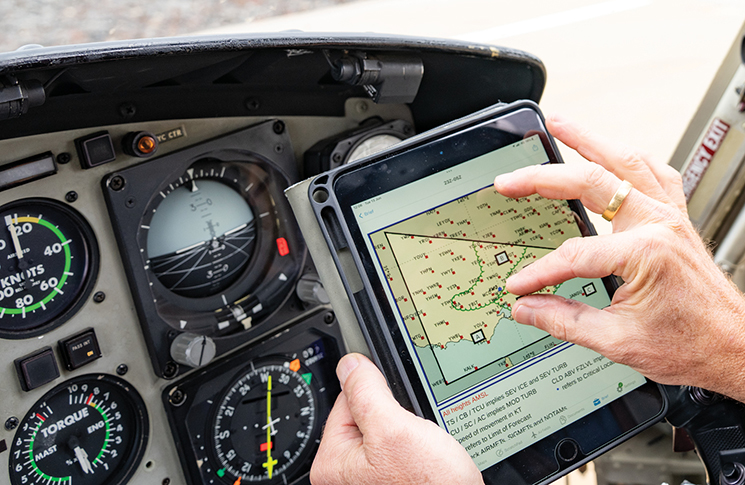
EFBs have changed the landscape for pilots for flight planning, but the jewel in their crown is their weather planning functions.
However, learning to use an EFB takes time and study. Bas Scheffers, founder and chief executive of OzRunways, says, ‘Pilots can best use EFB weather tools by first developing awareness of the available features and investing time to learn their capabilities.’
The 3 major EFBs in Australia – AvPlan, Garmin Pilot and OzRunways – offer extensive training via their YouTube channels and websites.
Bevan Anderson, chief executive and founder of AvPlan, recommends spending extensive time with your EFB on the ground before flying solo. Another great tip is to take your EFB when flying in the right-hand seat. Following the mandate of, ‘never let an aeroplane take you somewhere your brain didn’t get to 5 minutes earlier,’ using an EFB as a copilot allows you to practice your EFB skills for weather planning while the pilot takes control of operating the aircraft.
Effective use of weather tools
Scheffers says understanding the tools available in your EFB is essential. By mastering those tools, visualising weather trends and planning conservatively with backups, pilots can establish a comprehensive weather picture that improves both safety margins and operational flexibility.
‘Tools like OzRunways’ SmartBrief provide integrated visual overviews of critical weather products, while eAWIS delivers near real-time updates from aerodrome weather stations, essential when conditions are deteriorating rapidly,’ Scheffers says. ‘The often-overlooked animation capability allows pilots to visualise weather system movement and progression, creating a dynamic mental model rather than relying on static snapshots.’
Anderson suggests taking a big-picture approach to begin with, before homing in on the smaller details.
‘Review the synoptic chart for your route, rain radar and visual satellite imagery,’ he says. ‘Then go deeper into the aviation forecasts like the graphical area forecast [GAF] for your route. Matching what you see in the satellite image with the GAF is a great way to build a mental picture of the en route weather. Last, look into the details of the aerodrome forecast [TAF] and METAR for the airports in your plan and along the route.’
All this weather information is imported from NAIPS, the national aeronautical information processing system.
Smarter diversions: using EFB weather tools for better fuel and route decisions
For rapidly changing conditions, creating a backup plan is crucial. This means identifying alternative routes and diversions while establishing personal minimums that may exceed regulatory requirements.
‘A great EFB app will monitor the changing weather while the pilot is in flight and provide timely notification about significant weather changes,’ Anderson says. ‘The pilot is then best placed to use that to decide to proceed to their destination or divert. AvPlan will already have the weather and NOTAMs for the diversion airport, so the flight can come to a successful conclusion.’
Scheffers says, ‘OzRunways’ weather features excel at providing immediate visual cues for diversion planning, through colour-coded aerodrome dots and SIGMET/AIRMET in SmartBrief when weather affects planned routes.
‘Cameras provide critical visual verification – you can literally see fog lifting before departure or identify when the TAFs forecast broken clouds but cameras show solid overcast requiring an alternate.
‘The “closest points” function quickly identifies closest airfields, while one-tap weather briefing provides immediate TAF, METAR, area QNH and NOTAM access for potential diversion airports.
‘SmartBrief’s interactive mapping combines multiple weather sources – GAFs, SIGMETs, AIRMETs, GPWT – to visualise weather systems, while eAWIS delivers minute-by-minute updates, versus the standard 30-minute METAR data for more current decision-making information.’
Weather and fuel
Scheffers says a critical advantage is dynamic integration of weather with fuel planning. Critical point/point of no return and fuel critical points are displayed on the map based on wind conditions from GPWT data and aircraft performance; this shows exactly where a diversion becomes necessary due to fuel constraints.
‘The fuel planner automatically calculates fuel requirements for diversions including climb and cruise segments,’ he says. This creates a systematic decision-making process:
- identify deteriorating conditions through visual indicators
- evaluate alternates using quick search and briefing tools
- compare conditions via SmartBrief
- assess fuel requirements through integrated planning
- execute diversion with new flight plan activation.
‘By combining weather awareness, navigation and fuel management in one interface, pilots reduce cognitive workload during high-stress scenarios, while making more informed, time-critical diversion decisions.’
Know your limits: managing in-flight weather gaps
While EFBs provide weather capabilities that significantly improve flight safety, pilots must understand their in-flight limitations to use them effectively.
‘The primary constraint to EFB weather is connectivity dependency,’ Scheffers says. ‘Most weather products require internet access to refresh, and Australia’s vast geography means cellular coverage can be unreliable in remote areas. OzRunways helps mitigate these challenges through its comprehensive data downloading/offline capabilities, ensuring pilots begin each flight with the most current available information. Many pilots complement OzRunways’ advanced weather tools with traditional verification methods, like asking ATC, to maintain robust situational awareness.’
The primary constraint to EFB weather is connectivity dependency.
Anderson agrees. ‘Pilots need to be aware of how their chosen EFB software behaves when internet connectivity is limited,’ he says. ‘A good application will cache all the weather information prior to flight for the chosen route so it is available inflight, when internet connectivity may not be present. A great application will constantly keep this data up-to-date when there is connectivity present, so the most recent picture is available to the pilot.’
Pilots also need to be aware of the limitations of some of the weather visualisations, such as the rain radar. There can be a delay between the time the image is created by the Bureau of Meteorology and that being available in your EFB.
While an EFB is a powerful asset for weather planning, it should never replace sound pilot decision-making.
Anderson says the distance of the rain from the radar may make weather look more benign than it is. ‘The curvature of the earth can mask some low-lying weather,’ he says.’Use other information such as lightning to build a more complete picture of weather.
‘Rain radar needs to be considered a strategic weather avoidance tool and not a tactical one. Dedicated weather detection avionics such as your eyes, onboard weather radar and strike finders are appropriate tools for tactical weather avoidance.’
Weather to go: common mistakes and how to avoid them
While an EFB is a powerful asset for weather planning, it should never replace sound pilot decision-making. Technology can improve situational awareness and support decision-making, but it doesn’t interpret context, evaluate risk or weigh operational realities, the way a human can.
‘Pilots should establish clear personal boundaries before viewing weather information,’ Scheffers says. ‘Regularly verify data currency by checking timestamps and use OzRunways’ SmartBrief feature to examine weather at multiple airports along their route for a comprehensive picture.
‘Both VFR and IFR pilots must remember that advanced EFB capabilities don’t replace pilot judgement. IFR pilots must still assess weather suitability beyond just legal cloud flying requirements. VFR pilots should be aware of weather throughout their entire route, not just origin and destination. All pilots must consider wind conditions and not exceed demonstrated crosswind limits from their pilot’s operating handbook [POH] regardless of personal confidence levels.
‘The key is taking the time to thoroughly learn all available EFB features and understanding the tools around you to be best equipped for decision-making, while maintaining proficiency with traditional weather interpretation as backup, ultimately trusting your judgement as pilot-in-command to make early, conservative decisions.’
Anderson agrees, adding, ‘Common mistakes would be interpreting time intervals in TAFs and how they relate to local time. Using the weather radar in your EFB as a tactical weather avoidance tool and inadvertently entering a thunderstorm happens more often than it should.’
Pilots must still assess conditions against their own experience, aircraft limitations and personal minimums. Trust the tools – but trust your training more.
Ultimately, the best decisions come from balancing digital insight with hands-on airmanship, as I discovered on the second time an EFB saved my bacon. But that’s another story…
Top 5 tips for using EFB weather tools effectively
1. Start big, then drill down
Begin your weather briefing with the ‘big picture’: synoptic charts, rain radar and satellite imagery. These give essential context.
Once you understand the broader weather systems at play, move on to aviation-specific products like GAFs, TAFs and METARs.
Cross-referencing visual satellite images with GAF forecasts builds a more accurate mental model.
2. Take your tablet flying from the right-hand seat
Flying from the right-hand seat means adapting how you use your EFB. Practise on the ground to streamline muscle memory, especially for actions like zooming, tapping or accessing charts.
A well-prepared EFB setup improves safety, reduces workload, and keeps your situational awareness sharp.
3. Cache before you fly
Most EFBs depend on internet connectivity to refresh weather inflight; something that can’t always be guaranteed once airborne.
Always pre-load the latest weather data before departure. Know your app’s capabilities for caching and be cautious with rain radar: it’s delayed and best for strategic planning, not last-minute tactical decisions.
4. Integrate weather with diversion and fuel planning
Smart EFBs don’t just display weather – they merge it with fuel and route data.
Use features like graphical wind and temperature (GPWT) to determine when weather might force a diversion. Visual tools such as coloured aerodrome dots, camera feeds and critical fuel points help make timely, well-informed choices in flight.
5. Avoid the classic traps
Be careful when reading forecast times and don’t assume legality equals safety.
Always verify TAF/METAR timestamps and be wary of treating your EFB like onboard radar, especially in convective weather.
Know your crosswind limits, and don’t exceed them because the POH says it’s technically possible. Trust your judgement and plan conservatively.
Further information
CASA supports the aviation industry and individual pilots in the safe and efficient use of EFBs. Advisory Circular AC 91-17 Electronic flight bags offers detailed information about their use.
Weather and forecasting is one of the special topics on our pilot safety hub. Refresh your knowledge.


