

I cancel trip after trip, even on clear blue days, because I worry the weather for my return journey in a week’s time might not be good enough to get home safely.
I dread the idea of being stuck for days in some godforsaken hotel because the rain has set in or clouds and turbulence are sitting across the mountains on my path home. It’s happened to me too many times. And I can tell you from experience, there are only so many games of Solitaire you can play on your phone waiting for the local RSL club to open its kitchen.
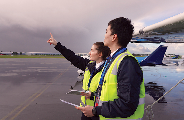
Checking the weather is one thing – standing on the apron deciding whether to take-off now or in 2 hours is different.
As you would expect, some of the scariest moments of my flying career were when I have tried to push on through dodgy weather, often when close to home. Several of these near misses remain in my nightmares. I’m not the only one either. Get‑there‑itis is far too common.
The dangers of weather
The ATSB makes the point that flying into weather remains one of its most significant causes for concern in aviation safety. ‘The often-fatal outcomes of these accidents are usually all the more tragic because they are avoidable,’ it says.
There’s a clear lesson here: conservative decisions around weather are not weakness – they’re good airmanship.
You don’t have to hit me too many times before I get the message. Rather than risk a flight into IMC on the way home or possibly just as dangerous – risking the local RSL club’s roast of the day – I choose to stay at home if the longer-range forecast doesn’t look good.
The often-fatal outcomes of these accidents are usually all the more tragic because they are avoidable.
So how does a pilot work out if the flight home will be done safely, and preferably in one go?
The outbound trip is relatively straightforward. Aerodrome forecasts and other widely available aviation weather services provide a comprehensive and reliable source of information.
But, according to the Bureau of Meteorology, these services are only good if you want to leave today or tomorrow. The TAF is good for maximum of 30 hours at major airports and only up to 12 hours at smaller places, and GAFs only have a 6 hour validity period.
These aviation forecasts and services should remain your primary source for go/no-go decisions. Longer-range products help identify trends – but not make final decisions.
But what to do for next week? The bureau says for that we should use its public weather service.
Reading the future
According to the US National Oceanic and Atmospheric Administration, a forecast one to 3 days out is usually only 90% accurate.
So, while a seven-day forecast may not give you a definite go/no-go decision, there are things you can do to give yourself a better idea.
A key takeaway: forecasts beyond a few days are useful for identifying trends – but not for committing to a flight.
Because of supercomputers, the bureau forecasts include probability. You can use this to spot trends which may affect your flight.
A forecast containing a 20% chance of rain is not enough to make me cancel, but any chance at all of rain in the forecast area raises my awareness. Is bad weather lurking there somewhere? If the probability hits 40 or 50%, I’m leaning towards staying home.
If my flight is along the coast, I will turn to PredictWind. It draws on multiple global weather models and presents trends visually, which can help identify potential weather windows. But like all long-range tools, its accuracy decreases the further ahead you look.
The best tool in the bag
However, my primary tool remains what it was from the early days of my training – the synoptic charts published by the bureau.
These charts can be hard to interpret at first, but if you persist with them and learn their ways, they can give you the clearest picture you will get of what the world will look like in the days ahead.
There are the simple things: If the isobars are close together, it will be windy. It will be calm if the lines are far apart. Cold and warm fronts are clearly marked. Those are the areas where the temperatures and air pressures change rapidly. You don’t want to be near them if you can avoid it.
Using synoptic charts, it’s easy to identify large weather systems when they are still far away. A high-pressure system will usually bring calm, settled weather (hint: good flying weather). A low-pressure system will bring rain and unsettled conditions.
Using synoptic charts, it’s easy to identify large weather systems when they are still far away.
Looking at a week’s worth of synoptic charts side by side, it’s relatively easy to see what will happen in your neck of the woods over the next few days. As your departure day nears, using the charts in combination with the bureau’s TAFs and area forecasts will give you enough confidence to make a go/no-go decision and you should expect to be close to the mark.
As your departure day approaches, combining these charts with TAFs and area forecasts will support a more informed decision but flexibility is still essential.
The ATSB tells you in the accident statistics that weather is an uncertain and uncompromising factor in flying. No one gets it right every time. But if you keep in the back of your mind the consequences of getting it wrong, you should get home safely and even enjoy the experience.
That’s why every flight needs a plan B: delay, divert or cancel.
And once airborne, be prepared to reassess and turn back early rather than press on into deteriorating conditions.

A perfect plan
One time I had to relocate an aeroplane from the Gold Coast to Sydney. The weather had turned cooler and I was looking for a particular window of opportunity. One where the conditions were good enough to fly commercially to the Gold Coast and return in the aeroplane the next day. It didn’t really have to be done so fast, but I was trying to save money on my quarterly hangar rental fee. And yes, I was aware that the urge to save money could push me into making an unsafe decision. I tried to factor that in.
By the time I was ready to go, the endless blue days of early autumn had given way to the blustery, cold conditions of winter, so my weather waiting game was long and tiring. Front after front marched across NSW, bringing bitterly cold weather and strong winds. No VFR conditions for weeks on end. Then one day, with time running out, I noticed an unusual aspect on the latest synoptic charts I was studying, like they were the form guide for the Randwick gallops.
I was aware that the urge to save money could push me into making an unsafe decision.
A strong front was due through NSW the following Tuesday (it was Friday now) and expected to bring strong winds and rain. It was fast moving and the different weather programs I consulted all agreed it shouldn’t last more than a day. Marching right along behind it was a second, slower and weaker front, expected to bring similar conditions which would persist. Between the 2, there appeared to be a gap of perhaps a day where the air would be settled and still and the sky clear. It would be a narrow window but the more I looked at it, the more I felt it was a feasible one. I made the choice to go – but knowing I would walk away if conditions didn’t match the forecast.
I booked the jet for early Tuesday and made my way to the airport in rain and blustery conditions. The flight was packed and delayed by more than an hour. The weather was just as bad on arrival on the Gold Coast. I started to think I had wasted my money. I went to bed early that night, fully expecting to have to book another jet back to Sydney to wait for another day.
But when I arose before dawn, the sky was clear and there wasn’t a breath of wind. That high-pressure lull between the 2 fronts had arrived
on top of NSW just as the synoptic chart had forecast.
I updated the weather and winds for my flight plan, which confirmed my local observations and set out an hour or so after dawn. I enjoyed a completely beautiful day’s flying. There was the merest touch of a headwind up high but nary a cloud over Australia that I could see. My beautiful aeroplane operated perfectly and there was no one else up there with me.
I made one stop on the way to fill up with fuel. My overly cautious nature insists I not arrive in Sydney without near-to-full tanks, in case I have to turn around and go back north to find a landing place. I made it to my destination just after lunchtime in glorious sunshine. I was very happy. I was even happier that night when the wind picked up and started to blow. The next morning was grey, cold and wet. It blustered for weeks.
On this occasion, the plan worked. But just as easily, that window could have closed early – and I was prepared for that outcome.
I celebrated by going to the nearest RSL club for a roast of the day.

Conclusions
Weather is one of the most common contributors to fatal accidents but it’s also one of the most avoidable.
If your plan relies on long-range forecasts, build in flexibility. If conditions don’t match the forecast, don’t go.
The safest pilots aren’t the boldest. They’re the ones willing to wait.
More information:
Weather and forecasting is one of the special topics on our Pilot safety hub. Visit casa.gov.au/pilots to refresh your knowledge.